Executive summary
Deadly flooding in Gaborone during 2025 followed episodes of intense rainfall that overwhelmed urban drainage systems and low-lying neighbourhoods. World Weather Attribution analysis finds that climate change increased the likelihood of extreme rainfall, while rapid urbanisation and growing exposure were major drivers of the severity of impacts. The study highlights how climate hazards and urban development patterns are interacting to increase flood risk in fast-growing cities.
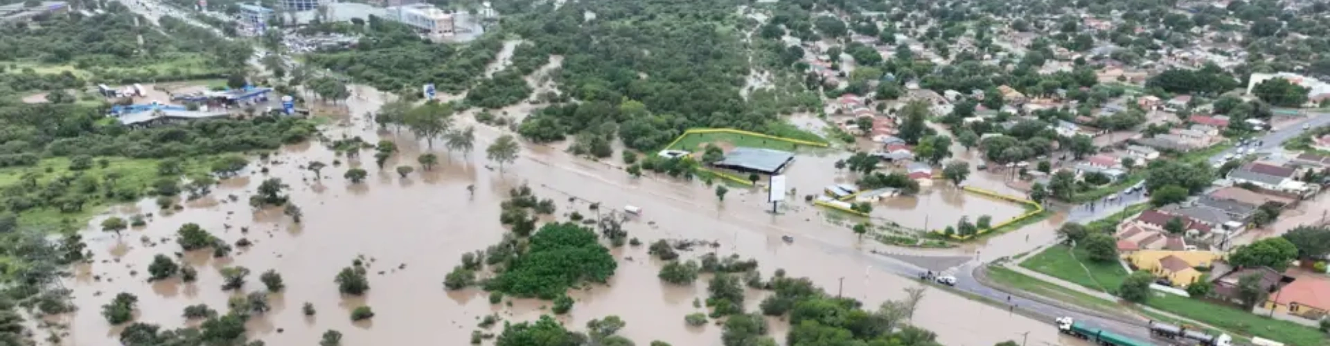
What happened
In 2025, Gaborone experienced periods of very heavy rainfall over short timeframes. Surface water accumulated rapidly across the city, flooding residential areas, roads and critical infrastructure. Several neighbourhoods were severely affected, resulting in loss of life, displacement and significant damage to homes and public assets.
Urban expansion into flood-prone areas, combined with limited drainage capacity and blocked waterways, reduced the city’s ability to manage intense rainfall. In some areas, floodwaters rose quickly, leaving little time for evacuation.
What the attribution analysis found
World Weather Attribution finds that climate change increased the likelihood of extreme rainfall events affecting Gaborone. Warmer atmospheric conditions allowed storms to hold and release more moisture, leading to heavier downpours.
The analysis shows that rainfall intensities similar to those observed in 2025 have become more likely in today’s climate compared with a pre-industrial baseline. While rainfall variability remains high, the influence of warming on extreme rainfall is clear.
The study emphasises that even relatively modest increases in rainfall intensity can lead to large increases in flood impacts when urban systems are not designed for such extremes.
Urbanisation and exposure as key risk drivers
A central conclusion of the analysis is that rapid urbanisation played a decisive role in shaping impacts. Expansion of housing and infrastructure into low-lying and flood-prone areas increased exposure, while drainage and flood management systems did not keep pace with population growth.
Socio-economic vulnerability further amplified impacts, with lower-income communities often located in the most flood-exposed areas and facing greater barriers to recovery.
How climate attribution fits into urban flood risk reporting
Climate attribution helps clarify how climate change is altering rainfall hazards, but it also highlights that hazard alone does not determine disaster outcomes. In this case, attribution shows that climate change increased rainfall intensity, while urban development patterns determined the scale of impacts.
This distinction is critical for effective urban risk management.
Why this matters for organisations
For municipal authorities, utilities, insurers and businesses operating in Gaborone, the findings highlight rising exposure to flood-related disruption. Transport networks, water and sanitation systems and residential areas are increasingly vulnerable to intense rainfall events that exceed historical design standards.
How to use this in your own risk work
Organisations should integrate climate-adjusted extreme rainfall scenarios into urban flood risk assessments, review land-use planning and drainage capacity and prioritise investment in resilient infrastructure. Addressing exposure through inclusive urban planning will be essential to reducing future flood impacts.
Source
World Weather Attribution (2025). Increasing extreme rainfall and rapid urbanisation major drivers behind Gaborone’s deadly floods.
https://www.worldweatherattribution.org/increasing-extreme-rainfall-and-rapid-urbanisation-major-drivers-behind-gaborones-deadly-floods/